Settlements and landscape: analysis techniques
The analysis is done with GRASS GIS.
Input Data
- A raster DEM of the studied territory. You can obtain an aspect map
from it using the
r.slope.aspectmodule. - A vector map of sites or buildings dating from a defined period.
The steps to the analysis
Preparing data
Convert the vector map to raster with the command:
v.to.rast input=edifici output=edifici.mask use=val layer=1 value=1 rows=4096
Remember that this conversion is run following the region settings. You can view the region settings with:
g.region -p
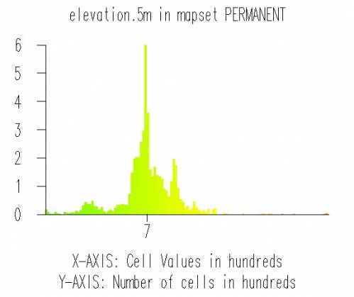
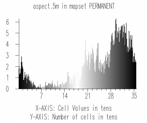
Now the resulting raster map becomes our MASK:
r.mask input=edifici.mask maskcats=*
From now on, all subsequent operations will be limited to the cells
defined in our MASK, corresponding to built areas or settlements.
If you need to remove the MASK, remember it a raster map like any
other one:
g.remove rast=MASK
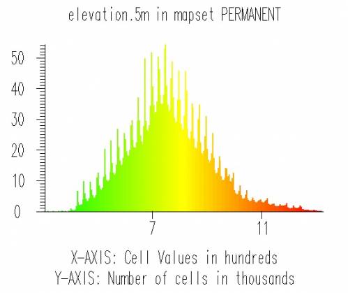
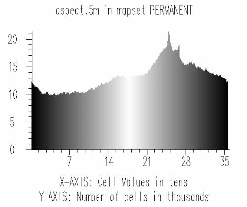
Histograms
The simplest analysis we can run is d.histogram. These are the
histograms of elevation and aspect for the whole of our study
area. Aspect is calculated counterclockwise from east, thus 0 = 360 = E,
90 = N, 180 = W, 270 = S. See
http://grass.itc.it/grass62/manuals/html62_user/r.slope.aspect.html
for the manual page of r.slope.aspect.
Applying built.areas as MASK results in these histograms:
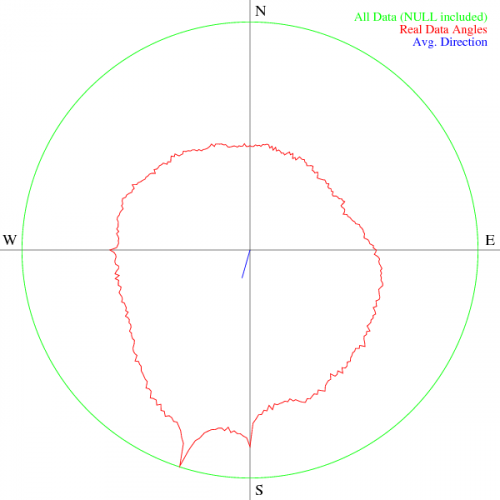
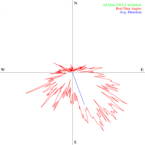
Polar diagrams
Aspect values are counted from 0 to 360 in degrees. So it would be better to plot aspect in a polar diagram instead of an histogram.
The d.polar module does exactly what we need. Its complete
documentation is at
http://grass.itc.it/grass62/manuals/html62_user/d.polar.html .
It’s handy to directly save the diagram to an EPS file for subsequent operations (inclusion in a LaTeX file, conversion to other graphic formats with ImageMagick, ...). Then you can use this command to get your diagram
d.polar map=aspect.5m@PERMANENT undef=0 eps=all.eps
These are the results:
Results
This simple exploratory analysis leads us to understand that in the study area there's a strong preference for sites exposed S-SE, built mostly around 700 meters above sea level.